Climbing Ben Nevis: routes, times and where to camp
· Updated
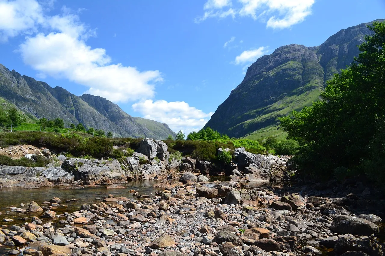
Ben Nevis is the highest mountain in Britain at 1,345 metres, and almost everyone who reaches the top does it on one path: the Mountain Track from Glen Nevis, near Fort William in the Scottish Highlands. It is roughly 10.5 miles (17km) there and back, with about 1,352 metres of ascent, and you should allow seven to nine hours. It is a serious mountain day, not a stroll, and the summit is one of the most exposed and cloud-covered places in the country.
This guide covers the standard route, timings, the kit you need, and the summit navigation that catches people out every year. It is part of our wider guide to camping along the UK's national trails, and it comes from Camping Sites in Britain, where you can find and compare campsites across the Highlands and the rest of the UK.
Get the mountain on a clear day and it is one of the finest walks in Scotland. Get it wrong in poor visibility and it is genuinely dangerous, so the safety section below is the part to read twice.
The routes up Ben Nevis
There are two realistic ways up: the Mountain Track for walkers, and the Carn Mor Dearg Arete for experienced mountaineers. They are not close in difficulty.
| Route | Distance (return) | Ascent | Time | Who it suits |
|---|---|---|---|---|
| Mountain Track (Pony Track / Tourist Route) | 10.5 miles / 17km | 1,352m | 7 to 9 hours | Fit walkers with navigation skills |
| CMD Arete (Carn Mor Dearg Arete) | Longer, harder | Around 1,500m | 9 to 11 hours | Experienced mountaineers only |
The Mountain Track
The Mountain Track is the standard walkers' path and the one this guide assumes you are taking. It is also called the Pony Track or the Tourist Route, though "tourist" undersells it badly. It starts from Glen Nevis, near the visitor centre, climbs steadily to the halfway lochan, then zig-zags up the stony upper mountain to the summit plateau.
The path is clear and well built lower down, but the higher you go the rougher and rockier it gets, and the last section is loose stone that is hard on the knees on the way down. There is no shelter and no water you should rely on once you leave the halfway point, so carry what you need.
The CMD Arete
The Carn Mor Dearg Arete is a much harder, exposed scramble and it is for experienced mountaineers only. It links the neighbouring peak of Carn Mor Dearg to Ben Nevis along a narrow, rocky ridge with big drops on both sides, and it requires scrambling confidence, a head for heights and solid mountain judgement. If you are asking whether you are ready for it, you are not. Take the Mountain Track.
Summit safety and navigation
The summit plateau of Ben Nevis is the most serious part of the mountain, and navigating off it in cloud is where people get into real trouble. The top is broad, flat and notorious for low cloud, and it is ringed by steep cliffs with two gullies that funnel walkers off the safe line. Mountaineering Scotland is blunt that the summit sits on the edge of the cliffs, with steep gullies on either side of the descent route (Mountaineering Scotland).
You cannot navigate the plateau by sight in cloud, and you cannot follow footprints or a worn line safely, because the safe line is not obvious. You need a map, a compass and the ability to walk on a bearing. The recognised safe descent is to walk 150 metres from the summit cairn on a grid bearing of 231 degrees, which takes you clear of Gardyloo Gully, then follow a bearing of 282 degrees down to the top of the zig-zags, keeping you clear of Five Finger Gully. Those are the two killer gullies, and drifting into either of them off the top has cost lives.
A few rules that keep the summit safe:
- Carry a map and compass and know how to use them. A phone is a backup, not a plan; batteries die in the cold and signal is patchy.
- Know your bearings off the top before you go up. Write them down. The time to work them out is not when you are stood in cloud on the plateau.
- Turn back if the cloud is down and you cannot navigate. The summit will still be there another day.
- Check the mountain forecast. Use the Mountain Weather Information Service (MWIS) for the West Highlands before you commit.
For the wider principles that apply on any big hill, read our guide to mountain safety before you set off.
Weather and when to go
Ben Nevis makes its own weather, and it is colder, wetter and cloudier than Fort William below. The summit is under cloud for the great majority of the year, wind on the plateau can be far stronger than in the glen, and conditions can change within the hour. VisitScotland is clear that the mountain demands proper preparation whatever the season (VisitScotland).
Snow can lie in the gullies and on the summit into summer, and old snow patches near the top are firm and slippery well into June or July. From roughly October to May the mountain is a full winter climb that needs an ice axe, crampons and the skills to use them; that is a different undertaking from a summer walk and is beyond the scope of this guide. For a straightforward summer ascent, aim for a settled day between late spring and early autumn and start early.
What to carry
Pack for a mountain, not for the car park temperature. Even in summer the summit can be near freezing with driving rain, so the kit list is non-negotiable.
- Map and compass, and the skill to navigate on a bearing in cloud.
- Warm layers and full waterproofs, jacket and trousers, plus hat and gloves even in July.
- Sturdy, broken-in walking boots with ankle support for the loose upper ground.
- Plenty of food and water, more than you think, plus extra snacks for energy.
- Head torch in case the descent runs late, with spare batteries.
- First aid kit, phone and a portable charger, kept warm so the battery lasts.
Getting there and camping nearby
The Mountain Track starts in Glen Nevis, a short drive from Fort William, which is the main town for the mountain and easy to reach by road or on the West Highland Line by train. There is parking near the Glen Nevis visitor centre, and it fills fast on fine weekends, so arrive early.
The obvious base is the Glen Nevis campsite, right at the foot of the mountain, which puts you minutes from the start of the path and lets you begin early while the summit is most likely to be clear. Fort William itself has plenty of beds and supplies if you want a roof the night before. Browse the options and book a pitch through our directory of campsites in the Scottish Highlands.
If Ben Nevis is one summit on a bigger list, the other two national high points make natural companions: our guides to climbing Scafell Pike in the Lake District and walking up Snowdon in Eryri cover the routes, timings and camping for each.
Frequently asked questions
How long does it take to climb Ben Nevis?
Allow seven to nine hours for the return trip on the Mountain Track for a reasonably fit walker, including breaks. Slower walkers and poor conditions push that longer, so start early and keep an eye on the time to avoid descending in the dark.
How hard is it to climb Ben Nevis?
It is a long, strenuous mountain walk rather than a technical climb. The Mountain Track is within reach of most fit people, but 1,352 metres of ascent over rough ground is demanding, and the real difficulty is navigation and weather on the summit, not the path itself.
Do you need a guide to climb Ben Nevis?
No, if you are fit and can navigate confidently in poor visibility with a map and compass. If you cannot, hire a guide or join a group, because the summit plateau in cloud is no place to learn. In winter, a guide or proper winter skills are essential.
Can beginners climb Ben Nevis?
Yes, fit beginners regularly walk up the Mountain Track on a good summer day, provided they carry the right kit and can navigate. It is a big day out, so build up on smaller hills first and pick settled weather rather than gambling on a poor forecast.
When is the best time to climb Ben Nevis?
Late spring to early autumn, on a settled day, gives the best chance of a safe summer walk with long daylight. From October to May the mountain is a serious winter climb needing ice axe, crampons and winter skills.
What do you do in an emergency on Ben Nevis?
Dial 999, ask for the police, then Mountain Rescue, and give your location as accurately as you can. If you have no signal, register for the emergencySMS text service before you go so you can text 999 where a call will not connect.
The short version
Ben Nevis is Britain's highest mountain at 1,345 metres, and the Mountain Track from Glen Nevis is a seven to nine hour, 10.5 mile day that most fit walkers can do in good summer weather. The summit is the serious part: carry a map and compass, know your bearings off the top, and turn back if the cloud is down. Base yourself at a Highlands campsite near Fort William, start early, and give the mountain the respect it deserves.