Climbing Scafell Pike: routes, times and where to camp
· Updated
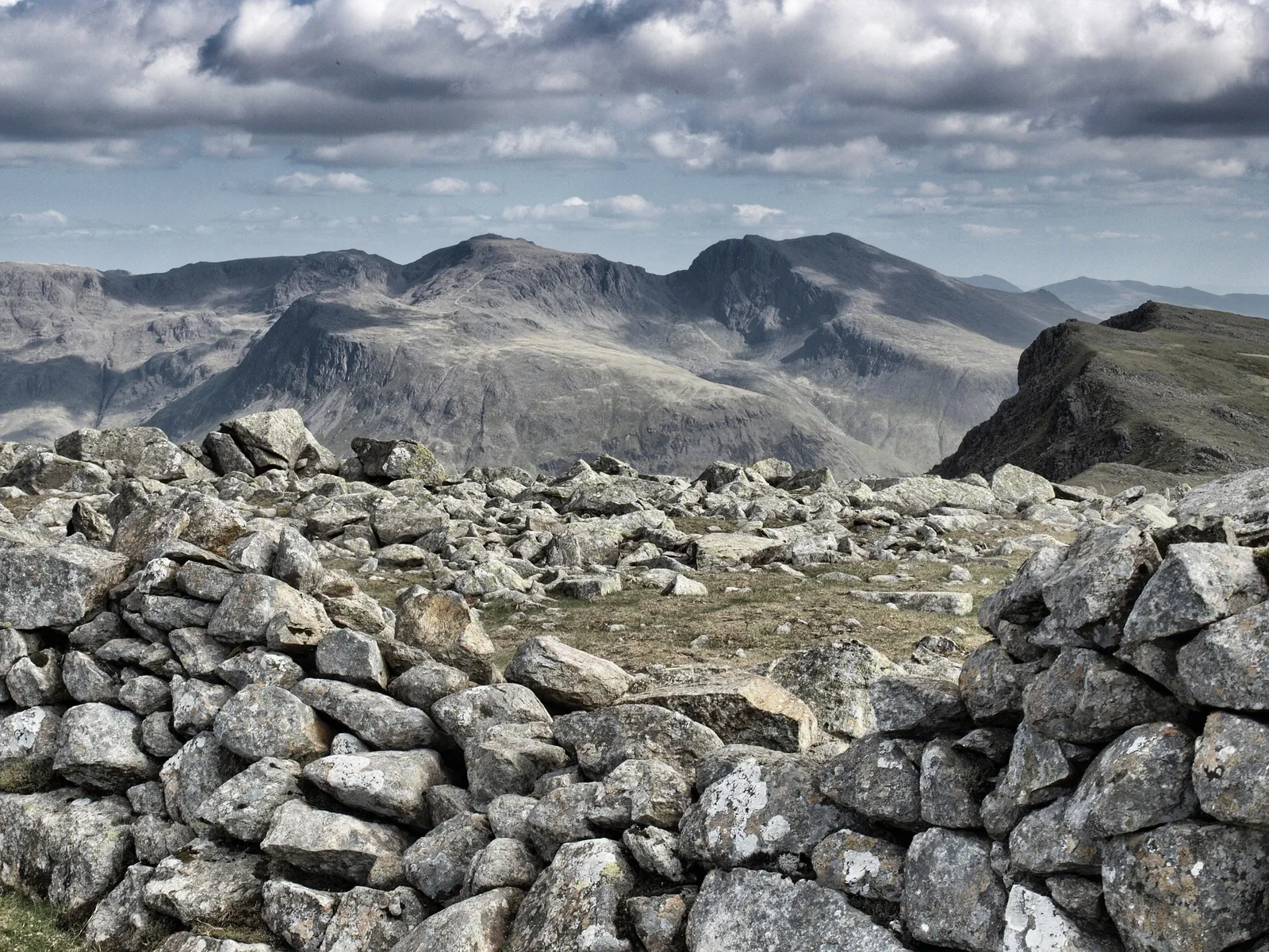
Scafell Pike is the highest mountain in England at 978m (3,209ft), sitting at the heart of the Lake District in Cumbria. The quickest way up is from Wasdale Head, a steep, rocky there-and-back of roughly 4 to 5 miles that most reasonably fit walkers complete in 3 to 4 hours to the summit. It is a serious mountain day in any weather, and the summit itself is a bare boulder field where cloud rolls in fast, so a map and compass are not optional.
This guide covers the four main routes up, how long each takes, where to park, and where to pitch up afterwards. It is part of our wider guide to camping along the UK's national trails, from Camping Sites in Britain, where you can find and compare campsites across the Lake District and the rest of the country.
The whole of the Lake District is a UNESCO World Heritage Site, and Scafell Pike is its high point. It is also the English leg of the National Three Peaks, so plenty of people meet it as one climb of three in a single day.
The four main routes up Scafell Pike
There are four established routes to the summit, and the right one depends on your fitness, your navigation and how much of a day you want. Wasdale Head is the shortest and busiest. Borrowdale and Langdale are longer and more scenic. Eskdale is the toughest and quietest.
| Route | Start point | Distance (return) | Time up | Character |
|---|---|---|---|---|
| Wasdale Head | Wasdale Head, Lake Head car park | About 4 to 5 miles | 3 to 4 hours | Shortest, steepest, busiest |
| Corridor Route | Seathwaite, Borrowdale | About 9 to 10 miles | 4 to 5 hours | Longer, scenic, via Sty Head |
| Langdale via Esk Hause | Old Dungeon Ghyll, Great Langdale | About 11 to 12 miles | 5 to 6 hours | Long, high mountain walking |
| Eskdale | Brotherilkeld | About 11 miles | 5 to 6 hours | Toughest, remotest, quiet |
Wasdale Head, the shortest and most popular
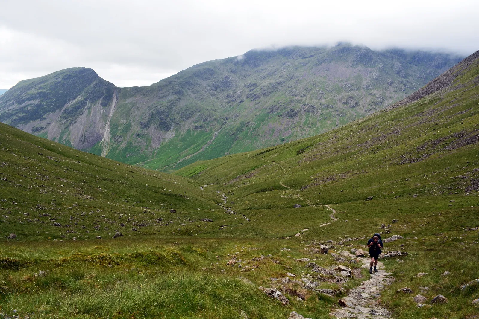
This is the route most people take and the one used for the Three Peaks. You start from the Lake Head car park at Wasdale Head, cross the fields to Brown Tongue, climb steeply into Hollow Stones, and pull up the final rocky ground to the summit. It is around 4 to 5 miles there and back with roughly 900m of ascent, so 3 to 4 hours up and a shorter return for most walkers.
Do not mistake shortest for easy. The path is relentless, loose and rocky higher up, and the top is a wide boulder field with no shelter. It is a proper mountain climb, and the Wasdale Head Inn at the bottom is a very good reason to get down safely.
The Corridor Route from Borrowdale, longer and more scenic
The Corridor Route is the classic scenic ascent and starts from Seathwaite in Borrowdale, the wettest inhabited place in England. You walk in via Stockley Bridge to Sty Head, then follow the Corridor Route as it traverses ledges and gullies high above Wasdale to reach the summit. It is around 9 to 10 miles return and takes most walkers 4 to 5 hours up.
It is more interesting underfoot than the Wasdale slog and gives you far better views, but there are a couple of short, exposed steps that need care, and the navigation off the top is harder. Save it for a clear day and settled ground.
Langdale via Esk Hause
The Langdale route is a big, high mountain walk that starts from the Old Dungeon Ghyll in Great Langdale. You head up Mickleden and Rossett Gill to Angle Tarn, cross Esk Hause, and take the stony path over to the summit. Reckon on around 11 to 12 miles return and 5 to 6 hours up, with a lot of high, open ground that is committing in poor visibility.
It is a rewarding day and quieter than Wasdale, but Esk Hause is a notorious spot to lose your bearings in cloud, so this one really does demand confident map and compass work.
Scafell Pike from Eskdale
Eskdale is the longest, toughest and least crowded way up, and the choice for walkers who want solitude. From Brotherilkeld you follow the River Esk past waterfalls and up onto the wild ground of Great Moss before the long climb to the summit. It is about 11 miles return and 5 to 6 hours up, over rough, pathless-feeling terrain in places.
This is not a first Scafell Pike. Take it on when you already know the mountain and your navigation is solid, because there is little passing traffic to follow if the weather turns.
Scafell Pike and the National Three Peaks
Scafell Pike is the English peak in the National Three Peaks, climbed alongside Ben Nevis in Scotland (1,345m) and Snowdon in Wales (1,085m). The classic challenge is to walk all three inside 24 hours, driving between them, and Scafell Pike is almost always done from Wasdale Head at speed, often in the dark.
If you are taking on the full round, read our companion guides to climbing Ben Nevis and walking up Snowdon before you commit to the clock.
Navigation and safety on Scafell Pike
The single biggest risk on Scafell Pike is losing your way on the summit. The top is a featureless boulder field, cloud sits on it for much of the year, and people regularly walk off on the wrong bearing and end up in the wrong valley or on dangerous ground. Carry a paper map and compass and know how to use them, and do not rely on a phone, because signal is patchy and a dead battery leaves you with nothing.
Check the mountain forecast before you set off. The Mountain Weather Information Service (MWIS) gives a proper hill forecast for the Lake District, including cloud base, wind and the chance of a clear top, which the valley forecast will not tell you. The Lake District National Park Authority publishes current mountain safety advice for the fells.
If something goes wrong on the hill, call 999 or 112, ask for the police and then Mountain Rescue, and give your location as best you can. A whistle, a head torch and knowing your grid reference all make you far easier to find. For the wider essentials, our guide to mountain safety covers what to carry and how to plan a hill day.
Kit to carry
- Map and compass, plus the skill to use them. This is the non-negotiable one
- Waterproof jacket and trousers, warm layers and a hat and gloves, even in summer
- Proper walking boots with ankle support for the rocky ground
- Head torch, whistle and a small first aid kit
- Plenty of water and high-energy food, and more than you think for the long routes
- A charged phone as backup only, never as your main navigation
Parking at Wasdale
Parking at Wasdale Head is limited and fills very early on any decent weekend. There is a National Trust car park at Wasdale Head plus roadside verges along the lake, and on busy days both are full by mid-morning. Arrive early, well before 9am in summer, or you may find nowhere legal to leave the car. The National Trust manages the fells here and its Climbing Scafell Pike page has current parking and route information.
Camping near Scafell Pike
The best base for the Wasdale Head route is right at the foot of the mountain, and there are good options in the neighbouring valleys too. Which you choose depends on the route you are walking.
- Wasdale Head. The National Trust Wasdale Campsite sits directly below the mountain and is the obvious base for the shortest route. Book ahead, as it is popular in season.
- Borrowdale. The valley for the Corridor Route, with campsites around Seathwaite and Rosthwaite and easy reach of Keswick.
- Eskdale. Quiet valley sites for the Eskdale ascent, and a good base if you want the wilder side of the mountain.
You can find and compare sites across the region on our Lake District and Cumbria campsites listings.
Frequently asked questions
How long does it take to climb Scafell Pike?
From Wasdale Head, the shortest route, most reasonably fit walkers take 3 to 4 hours to the summit and around 5 to 7 hours for the full return. The Borrowdale, Langdale and Eskdale routes are longer and take a full day.
What is the easiest route up Scafell Pike?
The route from Wasdale Head is the shortest and most direct at around 4 to 5 miles return. It is the easiest to follow but still steep and rocky, with about 900m of ascent, so it is a demanding mountain climb rather than an easy walk.
How high is Scafell Pike?
Scafell Pike is 978m (3,209ft) high, making it the highest mountain in England. It is the English peak in the National Three Peaks, alongside Ben Nevis in Scotland at 1,345m and Snowdon in Wales at 1,085m.
Do I need a map and compass for Scafell Pike?
Yes. The summit is a large boulder field that is often in cloud, and people regularly walk off on the wrong bearing. Carry a paper map and compass and know how to use them, and treat your phone as backup only.
Where can I park for Scafell Pike?
The usual start is Wasdale Head, where parking is limited to a National Trust car park and roadside verges. Both fill early on fine weekends, so arrive well before 9am in summer or consider starting from Borrowdale instead.
Where can I camp near Scafell Pike?
The National Trust Wasdale Campsite sits right below the mountain and suits the shortest route. Borrowdale is the base for the Corridor Route, and Eskdale offers quiet sites for the tougher southern approach.
The short version
Scafell Pike is England's highest mountain at 978m, and the shortest way up is the steep 4 to 5 mile there-and-back from Wasdale Head. Whichever route you pick, carry a map and compass, check the MWIS forecast, arrive early for parking, and treat the summit boulder field with respect in cloud.
Sort your base first, then the summit. Browse our Lake District and Cumbria campsites and pitch up close to the mountain.