UK Coastal Trails With Campsites: The Best Walk-and-Camp Pairings
· Updated

The best UK coastal trails for campers are the ones with a campsite within walking distance of the path, so you can pitch up, walk a section on foot and never move the car. Four stand out: the South West Coast Path around St Ives, the Pembrokeshire Coast Path near Tenby, the Norfolk Coast Path, and the Anglesey Coastal Path. Each has a proper campsite base and a day section you can walk in a morning or a full day.
This guide pairs each trail with a real campsite area and a specific stretch worth walking, then covers how to plan a point-to-point day with camping and how to stay safe around the tides. It is part of our guide to coastal camping in the UK, and it sits alongside Camping Sites in Britain, where you can find and compare the sites named below.
If you want the wider survey of Britain's long-distance coastal routes, read our companion piece on Britain's coastal pathways. This article is narrower on purpose: it is about the trail-and-campsite pairing, not the full network.
Four coastal trails with campsites nearby
These four pairings give you a good campsite and a walkable section of National Trail from the tent door. Distances are for the single section, not the whole path.
| Trail section | Rough distance | Campsite base | Directory |
|---|---|---|---|
| St Ives to Zennor (South West Coast Path), Cornwall | 6.5 miles one way | St Ives (Ayr, Trevalgan, Polmanter) | Cornwall |
| Tenby to Manorbier (Pembrokeshire Coast Path) | 7 miles one way | Tenby and Manorbier (Kiln Park, Well Park) | Pembrokeshire |
| Wells-next-the-Sea to Cley (Norfolk Coast Path) | 7.5 miles one way | Burnham Deepdale, Wells, Kelling Heath | Campsites |
| Holyhead and South Stack (Anglesey Coastal Path) | 7 mile loop | Holyhead and Trearddur Bay | Gwynedd nearby |
South West Coast Path near St Ives, Cornwall
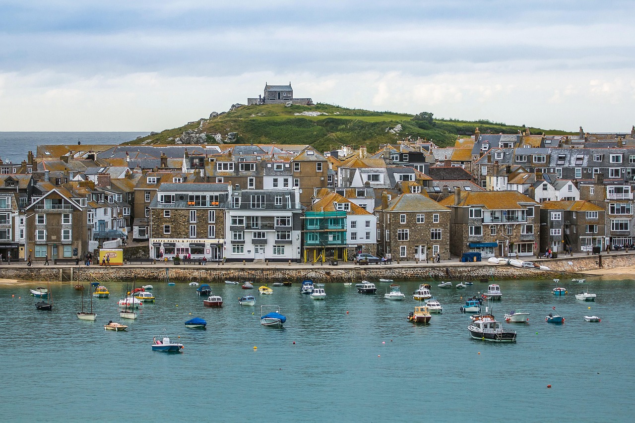
St Ives is the strongest camping base on the whole 630-mile South West Coast Path, because you can walk one of its finest sections and be back at the tent by evening. The stretch from St Ives to Zennor runs about 6.5 miles along the West Penwith cliffs, and it is genuinely strenuous: rocky, up and down, and slow going, so allow four hours and decent boots.
For campsites, look above the town where the touring parks sit within a mile or two of the path. Trevalgan Touring Park and Polmanter Touring Park both sit on the high ground west of St Ives with bus links down to the harbour, and Ayr Holiday Park is the closest to the coast path itself. Walk out to Zennor, have lunch at the pub, and catch the seasonal coaster bus back rather than doubling your mileage. You will find more options across the county in our Cornwall campsite listings.
Pembrokeshire Coast Path near Tenby
Tenby is the easiest coastal-trail base in Wales, sitting right on the 186-mile Pembrokeshire Coast Path with campsites inside the town. The path runs from Amroth to St Dogmaels as a National Trail, and the section south from Tenby to Manorbier is about 7 miles of clifftop with big beaches at Lydstep and Manorbier itself.
Kiln Park sits on the western edge of Tenby within walking distance of the South Beach and the coast path, and Well Park Caravan and Camping is a short way inland with a bus into town. Manorbier has its own small campsites if you would rather split the walk and stay a night at each end. Tenby to Manorbier works well as a linear day with the bus back, or as an out-and-back if the timetable does not suit. Compare pitches across the county in our Pembrokeshire campsite listings.
Norfolk Coast Path
The Norfolk Coast Path is the flattest and most family-friendly of the four, running 84 miles from Hunstanton to Hopton-on-Sea with almost no climbing. The best camping section is the salt-marsh coast between Wells-next-the-Sea and Cley next the Sea, roughly 7.5 miles past Stiffkey and Blakeney, with big skies, seals offshore and some of the best birdwatching in England.
Deepdale Backpackers and Camping at Burnham Deepdale is a well-run base right on the path, and Kelling Heath Holiday Park near Weybourne sits a little further east with its own halt on the North Norfolk Railway. Wells-next-the-Sea has campsites near the pinewoods and the beach. Because the path is flat and the villages are linked by the Coasthopper bus, Norfolk is the easiest place to walk one-way sections and ride back. Browse the full national picture in our campsite directory.
Anglesey Coastal Path
The Anglesey Coastal Path is a 124-mile circular route (200km) that begins and ends at Holyhead, and its wildest, most scenic stretch is right there at the start. The loop around Holyhead Mountain and South Stack lighthouse is about 7 miles of heath and sea cliff, with seabird colonies in early summer and views to the Llŷn Peninsula and Ireland on a clear day.
Base yourself around Holyhead or nearby Trearddur Bay, where several campsites sit close to the coast path and the South Stack circuit. Anglesey is a county in its own right, but if you want the wider North Wales choice, including the mainland shore and Snowdonia's edge, our Gwynedd campsite listings cover the adjoining area across the Menai Strait. The path here is well waymarked but exposed, so save the cliff sections for settled weather.
How to plan a point-to-point walk with camping
The trick with a linear coastal walk is deciding whether to move your camp or keep one base and use public transport. For most weekends, keeping one campsite and walking out-and-back or one-way with a bus home is far simpler than striking the tent every morning.
Base-camp method: pitch once, pick a section, walk it one way and catch the coaster or Coasthopper bus back to the site. This works brilliantly in Norfolk, around St Ives and along much of Pembrokeshire, where seasonal coastal buses shadow the path. Check the timetable before you set off, because many services run reduced hours outside July and August.
Moving-on method: if you want to walk a longer stretch over several days, book a chain of campsites a day's walk apart and carry a lightweight tent, or use a luggage-transfer service that moves your bags between sites. Pitch fees vary by site and season, so book ahead for summer weekends and bank holidays. For help choosing a good coastal pitch, see our guide to how to choose a site for beach camping, and if you are basing a trip around a harbour town, our guide to Britain's seaside towns for campers is a useful companion.
Tides and safety on coastal trails
Check the tide times before every coastal walk, because getting cut off by a rising tide is one of the most common reasons UK lifeboats launch. The RNLI recorded 274 lifeboat launches for tidal cut-off in 2024 alone, and coastal walking and running accounted for 563 deaths in the UK between 2019 and 2024, so this is the safety point that matters most (RNLI coastal walking advice).
Several sections here cross beaches, causeways or estuary edges where the sea covers the route at high water. Read the tide table for the day, plan to be past any low-lying stretch on a falling tide, and never assume you can outrun the water on soft sand or mud. Norfolk's salt marshes and Anglesey's causeways deserve particular respect.
Beyond tides, follow the same rules the RNLI and HM Coastguard give every year. Tell someone your route and expected return time, check the weather forecast, carry a charged phone in a waterproof pouch, and keep well back from cliff edges, which can be undercut and unstable. In an emergency at the coast, call 999 and ask for the Coastguard. For more on camping safely near the shore, read our tips for a safe and enjoyable beach camping experience.
Frequently asked questions
Which UK coastal trail is best for camping?
For a first trip, the Norfolk Coast Path is the easiest, because it is flat, well served by the Coasthopper bus and has campsites right on the route. For dramatic scenery, the South West Coast Path around St Ives is hard to beat, though the walking is much tougher.
Can you camp next to a coastal path in the UK?
Yes, on established campsites near the path, which is the approach in this guide. Wild camping is not a general right in England or Wales and needs the landowner's permission, so book a pitch at a recognised site rather than pitching on the cliffs.
How long is the South West Coast Path?
The South West Coast Path runs 630 miles from Minehead in Somerset to Poole Harbour in Dorset. Most campers walk short sections rather than the whole thing, and the St Ives to Zennor stretch of about 6.5 miles is one of the finest day sections.
Are the coastal trails suitable for beginners?
The Norfolk Coast Path suits beginners because it is flat and low-level. The South West Coast Path, Pembrokeshire Coast Path and Anglesey Coastal Path all have steep, rocky sections, so pick shorter clifftop stretches, wear proper boots and check the day's tide and weather.
Do I need to book campsites in advance?
Yes for summer weekends, bank holidays and popular spots like St Ives and Tenby, which fill fast in July and August. Outside peak season you can often turn up, but a quick call ahead confirms space and saves a wasted drive.
How do I get back to my campsite after a one-way walk?
Use the seasonal coastal buses that shadow most of these paths, such as the Coasthopper in Norfolk and the coaster services in Cornwall and Pembrokeshire. Check the timetable before setting off, as many run reduced hours outside the summer.
The short version
Pair a coastal trail with a campsite within walking distance and you get the best of both: a proper base and a great walk with no car shuffle. Start with St Ives, Tenby, the Norfolk marshes or Anglesey, check the tides every day, and use the seasonal buses to turn cliff paths into easy one-way walks. Find your pitch in our campsite directory or read the full guide to coastal camping in the UK.